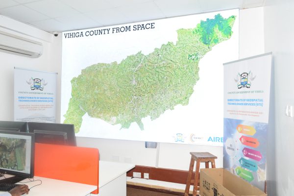
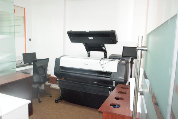
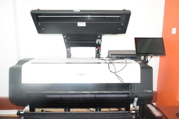
Establishment of Vihiga GTS/GIS Lab
Vihiga County Geospatial Technologies Services (GTS)/Geographical Information System (GIS) Laboratory is a service directorate anchored in the office of the Governor that provides linkages and services between county government departments in the use of geospatial data information for planning and decision making.
LocateIT Ltd undertook the conceptualization, design and installation of the labs fit-outs and GIS infrastructure (hardware, software, internet, network, etc) the seven sites housing the GIS facilities, namely; Vihiga County Government Headquarters in Mbale Town; the Emuhaya Sub-County office; the Hamisi Sub-County office; the Luanda Sub-County office; the Sabatia Sub-County office; the Vihiga Sub-County office and the Nairobi Liason office.

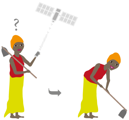
AfriCultuReS
Enhancing Food Security in African Agricultural Systems with the support of Remote Sensing.
AfriCultuReS aims to design, implement and demonstrate an integrated agricultural monitoring and early warning system that will support decision making in the field of food security. AfriCultuReS delivers a broad range of climatic, production, biophysical and economic information, for various regions in Africa. AfriCultuReS applies geospatial science to sustainable agricultural development, natural resource management, biodiversity conservation, and poverty alleviation in Africa.
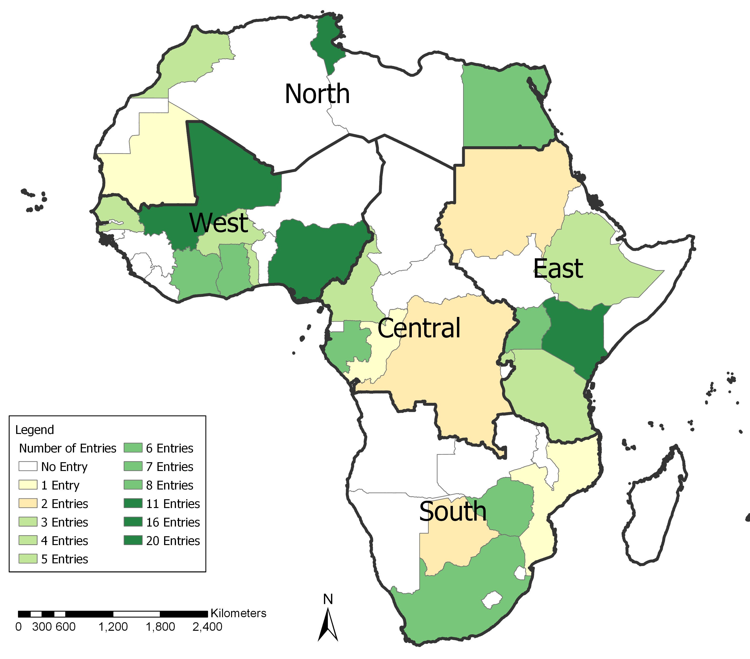
Comprehensive Survey of Earth Observation and Geospatial & Allied Technologies Private Sector in Africa.
The purpose of the study is to facilitate and inform the strategic interventions for EO industrial participation in Africa’s sustainable development as articulated in the African Space Policy and Strategy. The Study will help the continent through the African Union Commission, African Space Agency and other relevant institutions and programmes to derive and pursue realistic pathways anchored on facts and figures in the quest for a strong and thriving EO and geospatial & allied technologies..
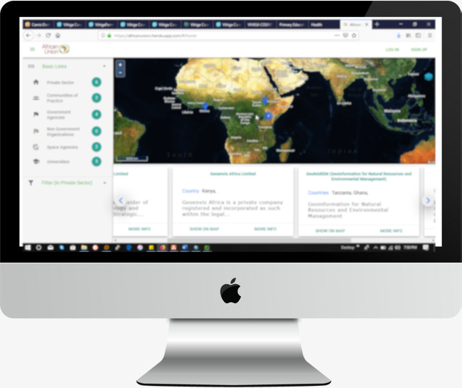
Development of A Comprehensive Business Directory of Earth Observation and Geospatial & Allied Technologies Stakeholders in Africa.
The EO/Geospatial Business Directory is a web map application having the following key components: A geo-portal displaying on a map all the private companies registered in the business directory and their geolocation. Listing of the other stakeholders – Academic/Research institutions, International organization and NGOs and Associations / Communities of practice.
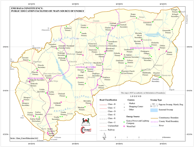
Emuhaya Constituency Development Information System (CDIS)
Working closely with the Member of Parliament for Emuhaya Constituency, Hon. Dr. Wilbur Ottichilo, LocateIT developed the first-of-its-kind Constituency Development Information System (CDIS) in Kenya that majorly leverages on ultra-modern geo-information technologies.

Proposing a Restoration Strategy for Mau Forest
Initiated as an in-house to demonstrate the role of GIS is natural resource planning and management, the project derived three empirically sound options that the Government of Kenya could pursue to cost-effectively and sustainably restore the Mau Forest. Unique aspects of the project include: use of high resolution historical and current satellite imagery to assess; and monitor forest loss patterns in the Mau; derivation of strategic options and budgets for phased restoration of the forest.
Others.
LocateIT implemented the project in collaboration with the Regional Centre for Mapping of Resources for Development (RCMRD) based in Nairobi, Kenya and Eurac Research based in Bolzano, Italy. The project aimed at developing prototype soil moisture content (SMC) products at high spatial and temporal resolution (ground resolution of 20m with weekly availability) by exploiting the synergy of Sentinel 1 and Sentinel 2. These products would help fill the gaps associated with global products that do not usually fit the specific needs of the local areas in terms of spatial resolution and accuracy. The project further developed tools that enabled end-users to adapt products to their area of interest.
LocateIT was contracted by the Kenya Marine and Fisheries Research Institute (KMFRI) to carry out mapping and monitoring of macrophytes (mainly water hyacinth and papyrus) in Lake Naivasha to determine the extent, distribution and dynamics thereof of the macrophytes in the lake over time.
LocateIT Ltd supported the Directorate of Resource Surveys and Remote Sensing (DRSRS) in development of smartphone driven geo-apps that were used by 51 local youths from Nyamira County to carry out mapping of key socio-economic aspects in the county. The apps developed for Nyamira County were used in the collection of field data on the following: household energy consumption, trading entities, education facilities, agricultural institutions, health facilities, hotels, social amenities, beautification sites, youth & women groups, cultural & heritage sites, industries, tree nurseries, aquaculture sites, and crop & livestock farmers, liquid and solid waste management sites, mining sites, tourist attraction sites, water points, and water consumption, among other socio-economic elements.
LocateIT Ltd supported the Directorate of Resource Surveys and Remote Sensing (DRSRS) to develop smartphone driven geo-apps that were used by 90 local youths to carry out mapping of key socio-economic aspects in the county. The apps developed for Mombasa County were used in the collection of field data on the following: trading entities (including pharmacies), education facilities, health facilities, hotels, beaches, social amenities, youth & women groups, cultural & heritage sites, industries, tree nurseries, fish landing sites, and crop & livestock farmers. LocateIT also supplied very high resolution Pleiades satellite imagery covering the entire Mombasa county at a spatial resolution of 50cm.
LocateIT Ltd supported the Directorate of Resource Surveys and Remote Sensing (DRSRS) to develop smartphone driven geo-apps that were used by 38 local youths to carry out mapping of key socio-economic aspects in the county. The apps developed for Kwale County were used in the collection of field data on the following: trading entities (including pharmacies), education facilities, health facilities, hotels, water points, social amenities, youth & women groups, kayas, places of worship, industries, tree nurseries, fish landing sites, and crop & livestock farmers. The County Government of Kwale hired 38 youths to carry out the field data collection. LocateIT also supplied high resolution SPOT 5 satellite imagery covering the entire Kwale county at a spatial resolution of 5m.
LocateIT implemented this project for and in collaboration with Equity Group Foundation (EGF). The project aimed at using geo-information technologies to map middle sized farms (5 – 100 acres) in Kenya with a view to improving farming efficiency and profitability. The project was implemented in twelve (12) counties, namely Trans Nzoia, Uasin Gishu, Nandi, Nakuru,Laikipia, Machakos, Muranga, Kiambu, Nyeri, Meru and Embu.
LocateIT implemented the project for and in collaboration with CAMCO Advisory Services (Kenya) Ltd. The project aimed to support the implementation of a REDD+ project (for carbon credits) in Mau Forest which is Kenya’s largest water tower. The project was hinged on four key aspects, namely biomass inventory, socio-economic assessments, remote sensing & GIS, analysis & reporting, and quality control.
LocateIT is implementing the project for and in collaboration with the African Conservation Centre (ACC) and the African Wildlife Fund (AWF). The project aimed at mapping community perception, land use / land cover changes, and land degradation in the rangelands of Amboseli – Kilimanjaro that span southern Kenya and northern Tanzania. This will help in deriving appropriate action plans to guide the restoration of the degraded parts of these important rangelands.
LocateIT implemented the project for and with MercyCorps through funding from DFID’s initiative dubbed “Building Resilience and Adaptation to Climate Extremes and Disasters (BRACED)”. The project aimed at analyzing (using remote sensing and GIS) the climatic and environmental changes in the arid and semi-arid regions of Wajir County in Kenya and Karamoja Region in Uganda with a view to understanding the implications to the livelihoods of the pastoralist communities living in those areas.
LocateIT conceptualized, designed and implemented this project to demonstrate the use of geo-spatial technologies in medium to long term agricultural planning. The project provides an empirical approach for strategic national planning of the agricultural sector (particularly in the wake of climate change challenge to agricultural sustainability and food security).